The classification framework employed by this risk assessment model was developed by Dr Gordon Macdonald as part of his doctoral research examining the impacts of global climate change on polar heritage sites. The model evaluates site vulnerability by relating geography, geology, and material composition to the likelihood, timing, and severity of climate‑driven impacts. These attributes, while not causal, indicate expected timescales of change and a site’s capacity to accommodate stress, enabling comparative differentiation under similar regional climate conditions ( Macdonald 2025 ).
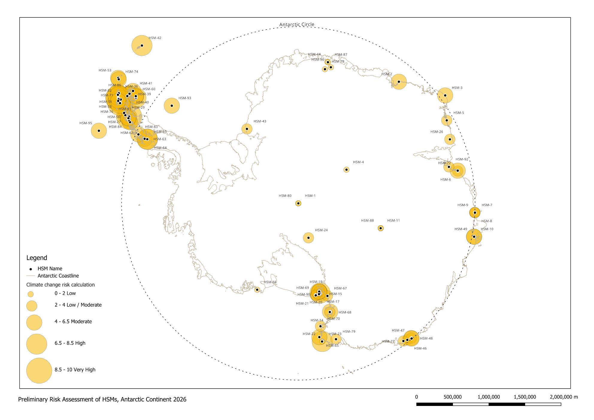
Macdonald’s initial research was based on an analysis of data collected from 11 HSMs in the Ross Sea Region with the support of Antarctic Heritage Trust (AHT) New Zealand. In 2025, he joined Dr Ruth Mullett from the UK Antarctic Heritage Trust (UKAHT) to assess an additional eight HSMs in the region of the Antarctic Peninsula. This brought the total number of sites inspected to 19, representing 21-percent of all Antarctic HSMs. Ground-truthing the model at this second group of sites in a different geographic region of Antarctica, illustrated the need for expanding the numbers of input data used in the risk assessment to include degrees of latitude.
Richard Greenwood developed and refined the online version of the risk assessment model over a three-year period 2023-2026. In 2026 Ben Gourley contributed to the project by developing a spatial database of all Antarctic Protected Areas using GIS.
How the tool works
The web-based tool assigns a numerical risk rating between zero (low) and ten (high). It is understood that multiple forces driving climate change impacts interact and create positive feedback and the risk assessment model allows for the combined influence of these forces on different types of sites. The tool accounts for interactions among climate drivers, such as the combined effects of sea ice loss, increased humidity, storm activity, temperature rise, and sea level change. Users respond to 11 assessment prompts for each site and can generate stored reports, upload visual material, and compare multiple locations.
There are 1,024 possible answers to the 11 initial questions because three of the questions have dependencies. The answers have varying independent impacts on the results: the nature of the materials, for example, has approximately half the initial influence as the geology of the site when each of these questions is considered on their own (Figure 1).
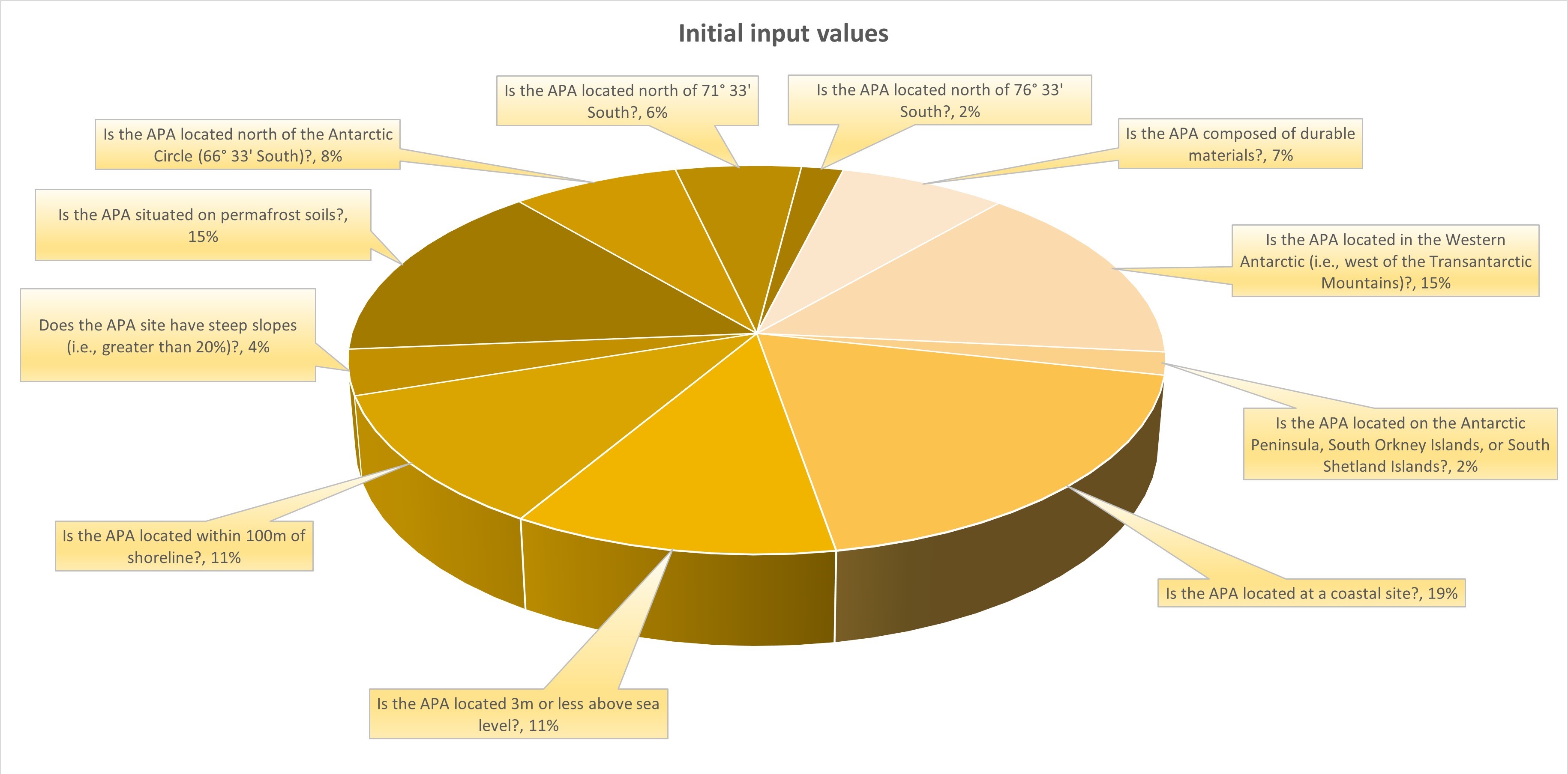
Figure 1 - Weighting of initial input values only, prior to accommodation of positive feedbacks. Source: Macdonald, 2026.
The tool then calculates for interactions (positive feedbacks) which are likely to happen when the circumstances of the initial answers occur together, therefore increasing or decreasing vulnerability to common climate change impacts (Figure 2). The secondary weighting distinguishes the relative severity of these impacts.
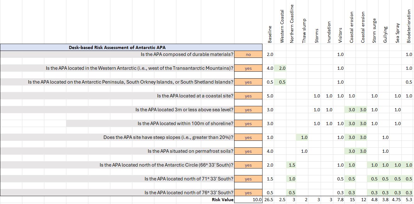
Figure 2 - Secondary weighting of risk values in relation to common climate change impacts. Source: Macdonald 2026.
The resulting risk value is therefore an approximation of the likelihood and severity of climate change impacts when various forces act in concert.
No longer "Frozen in Time"
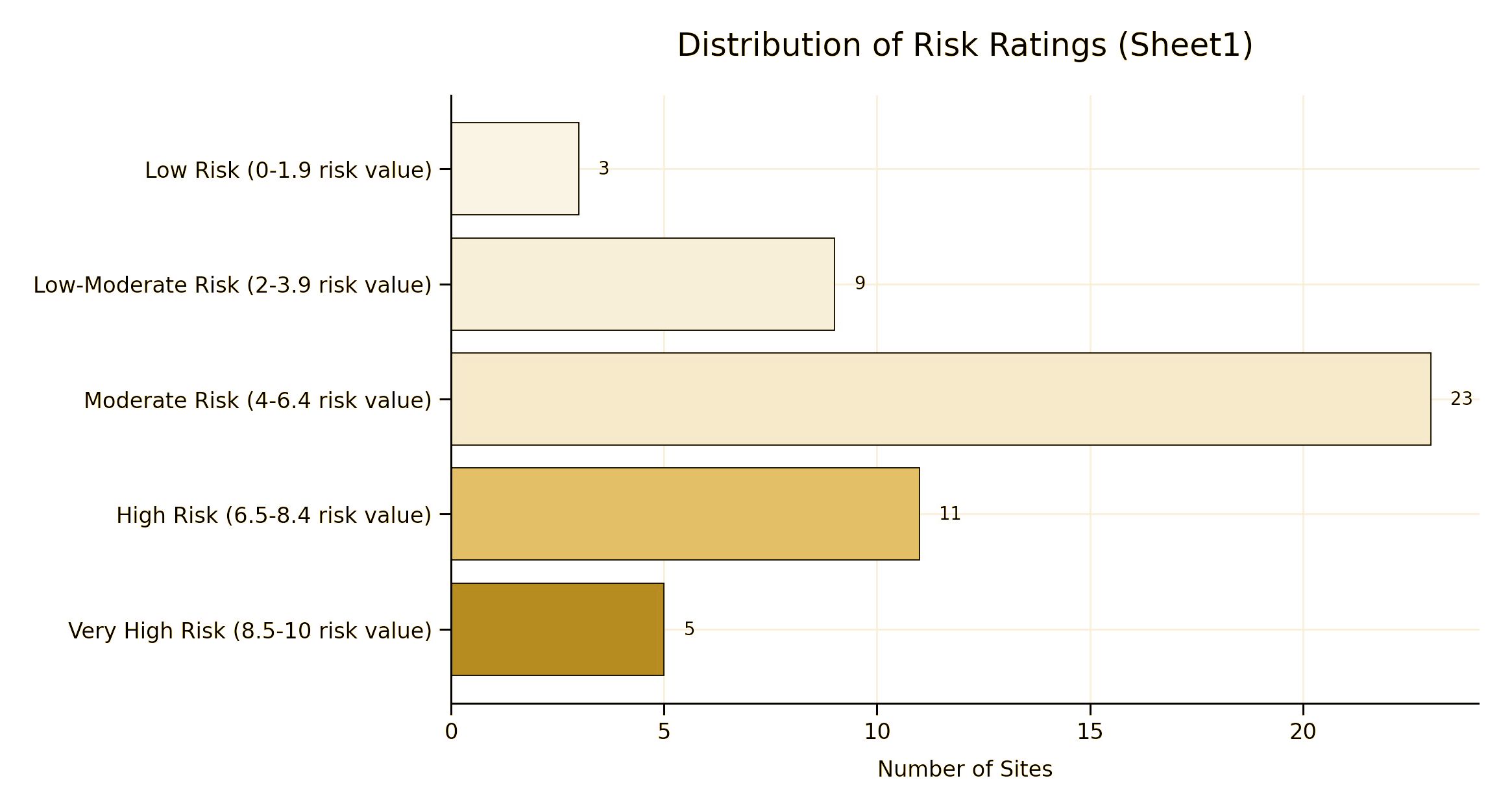
In 2026 the Committee for Environmental Protection (CEP) Working Group on Climate Change completed the first assessment of all Antarctic Historic Sites and Monuments (HSMs). While the findings are preliminary, they indicate nearly 20-percent of all HSMs currently fall withing the High or Very High risk categories.